
Ancient Waterways as Climate Strategy
Ancient Waterways as Climate Strategy
Mapping the Past to Plan for the Future

A recent article in Fast Company outlines the idea of “How ancient waterways could be tapped to cool scorching cities”. The specific focus is around new ways of scanning to reveal buried streams and ‘ancient waterways’, and how to see the hidden infrastructure and potentially repurpose the water for climate change adaptation strategies. The group leading this effort is called Cool City, which is an off-shoot of the Korean Pavilion as part of the 2021 Venice Biennale, with projects using mapping underway in both Naples and Seoul. The unique idea here is the use of handheld 3D scanning technology to provide more detailed scans of systems, and then to use the gathered data to inform decisions for climate.
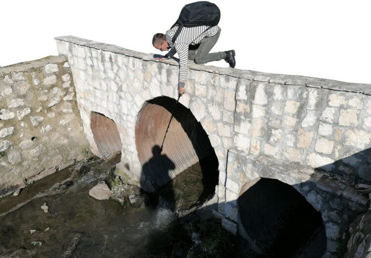
I’ve covered this topic in some detail at Hidden Hydrology, and there’s merit to this as a way of approaching climate change through the use of these buried systems, both as a resource for water for irrigation and passive cooling system, and as a way to increase pipe capacity by removing underground streams through daylighting which frees up vital volume for additional stormwater management.
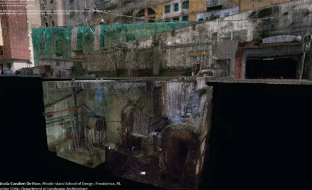
The work of mapping these has been done for many years, either as a GIS exercise with overlays of historical maps on current conditions, and subsequent field verification, and looking at current sewer and water and combined systems. This provides a good working system network in which to understand this hidden potential, but not forgotten water in the city, but Cool City is taking it to the next level, as mentioned in the article, quoting a project collaborator, Nick De Pace, a professor of architecture and landscape architecture at the Rhode Island School of Design:
“Buried streams and old waterways are not totally lost to time. Many cities have maps showing where a former creek has been shunted into an underground tunnel to make way for aboveground urban development, for example. But De Pace says many of these maps are imprecise, and the new digital scanning and mapping of the Cool City project can bring much more actionable detail to buried streams, aqueducts, and springs. By using this water to irrigate green roofs, parks, and other urban vegetation, cities can counterbalance their heat-trapping hardscapes.”
A snapshot of the scan below (which is unfortunately a bit lo-res on the post but you get the gist) shows how compelling this composite imagery may be showing the spaces above and below. Does it aid in climate planning, maybe? The mention use for irrigation for more green spaces for urban heat island mitigation, and having more water on the surface to reduce heat and provide more cooling. The mix of green and blue infrastructure systems can tap into the buried water to help adapt to climate change impacts.
I wonder, however, how feasible it will be to scan much of the sub-surface infrastructure as proposed above by Cool City, as it’s a mixed bag of small and large pipes, and some more expansive and cavernous sewers, depending on the location and the era in which they were implemented. It’s a question to me if it is useful to have 3D versions of these systems, or is mapping or modelling adequate to see the potential system components and flows and determining how it can be ‘tapped’ to become a tool to fight climate change.
The 3D scanning is a great tool for visualization for sure, as it is often difficult to imagine what lies beneath which is not as compelling as a line on a map. As mentioned in the article, just understanding more clearly what the available water resources are is half the battle. The next part is how to operationalize this water for climate strategies.
Interested to see more from Cool City and how the technology works, as well as what solutions emerge for using hidden hydrology for climate solutions.